The Armchair Archaeologist….
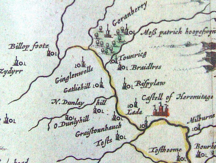
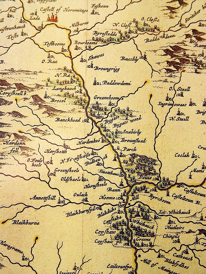
This is the Hermitage Valley from Timothy Pont’s survey of Liddesdale, circa 1583.
For ten years, from 1978 until 1988, my family and I lived at Dinleyhaughfoot, just above the “tower” marked as “Graistounhauch” on the map above, and I know this area well.
But back in those days, there was no “Google Earth,” and almost all of the overflight photographs were held by the Ministry of Defence, and “classified.”
Back in the 16th century, it is reputed that “Liddesdale” could field 3000 riders, and whilst I have commented elsewhere that this figure may have been exaggerated, due to the same riders being counted several times over, depending upon which “warlord” (sic) led the raid…… i.e on some occasions the riders were Armstrong’s (men) and not Armstrongs, (surname) and on the next the same men were Elliot’s (men) and not Elliots,(surname). That still means that Liddesdale, over the centuries was a heavily populated, even an overpopulated valley.
So…… Where are they all…. and where are all of those many thousands of burials?
Where are all of the towers, and other habitations?
Well….. No-one knows…. And the reason, in the main, is that no-one has really bothered to look!
Which is truly tragic. Because the people who were cleared out of this and other valleys, on both sides of the “Border Line” around the time of the Union of the Crowns, were some of the most dynamic people Britain ever produced, and they went onwards and outwards, throughout the world.


The “Borderers” were hugely responsible for the early colonisation of what is now the United States, and formed a very large contingent in the push west across that Continent.
And yet in their own homeland, because the clearance was so efficient, they are largely forgotten.
The Borderers as an ethnic grouping have almost disappeared, swamped out (in Scotland) to a great extent by the spread of the “Highland Image” of the Scot.
On the English side of the line, perhaps the last remnant is the “Geordie.”
And Tyneside to this day boasts a very large number of the old Border “surnames.” Mostly, because those who didmanage to remain after the clearances of the 16th and early 17th centuries, were forced off the land due to the mechanisation of farming in the 19th and 20th centuries, and they ended up in the mines, steelworks, and shipyards of Tyneside.
But now…… Thanks to modern technology, it is possible to sit at home, and to look for the very locations where the old time reivers actually lived!
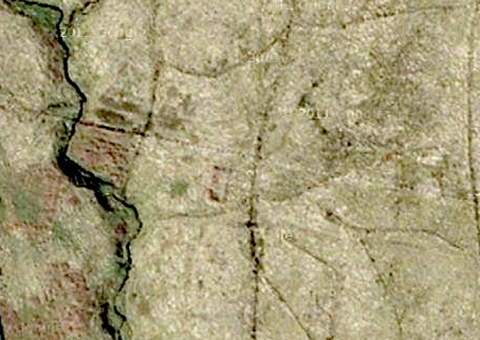
This is a satellite shot of “Lada” just to the left of Hermitage Castle on Pont’s map. (or at least I think it is. It has never been excavated.)
The house outline is around thirty feet long, and it lies on a “dry mound” just above a stream.
Look carefully, and you can make out a rectangular field enclosure just below the house.
I was told years ago, that this was one of the locations occupied by “The Croziers.” So if that is you… then you may just be looking at the Ancestral Estates! And there is a fair bet, that some of your forebears are lying there, looking up, from just under that turf….. not too far away at all.
(Bet that makes the hairs on your arms stand up and prickle!)
You know, if this was in the USA……. Native American…… First Nation….. whatever, then all of this valley would be protected, at least until it was properly recorded….. But it’s not…. and so it isn’t!
“Lada” is fairly typical of a Liddesdale “dwelling”….. not a tower at all….. just a small farmstead! And the valley ought to be littered with them. The problem is, that they are hard to see at most times of year, due to an overgrowth of bracken.

This is “Graystone Haugh”……. and Graystone Haugh Tower ought to be visible just to the left of the yellow text. But it isn’t……
Back in the 1980’s you could still see it, but since then, too many tractors have been over the site, and now it’s gone forever!
And that is the danger. Forestry, Farming, Windfarms. None of which, are particularly friendly to archeology. And without any doubt at all there is a marked reluctance amongst both landowners and councils to record what sites there are.
Go out there, and the last person you are likely to meet is an archeologist!
But here is a little bit more…….
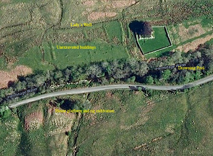
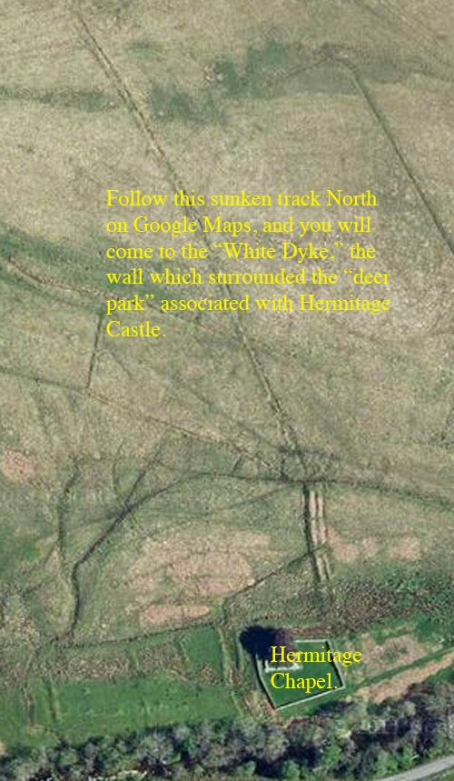
Here is the chapel just to the west of Hermitage Castle. The “Lady’s Well” is more ore less where marked, but so overgrown that I fell into it last time I was down there!
All of that just to the west is pretty much unexplored. The house platform, and rig cultivation is another typical “Liddesdale” dwelling.
The “Drowning Pool” is where the “Cout of Keilder” was allegedly held underwater by the spears of wicked Lord de Soulis’s men.
Another of Hermitage Chapel.
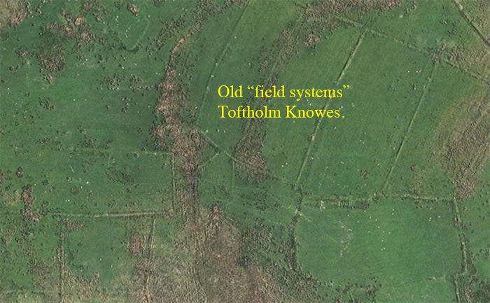
These are ancient turf walled field systems at “Toftholm Knowes” on the hillside south of Hermitage Castle.
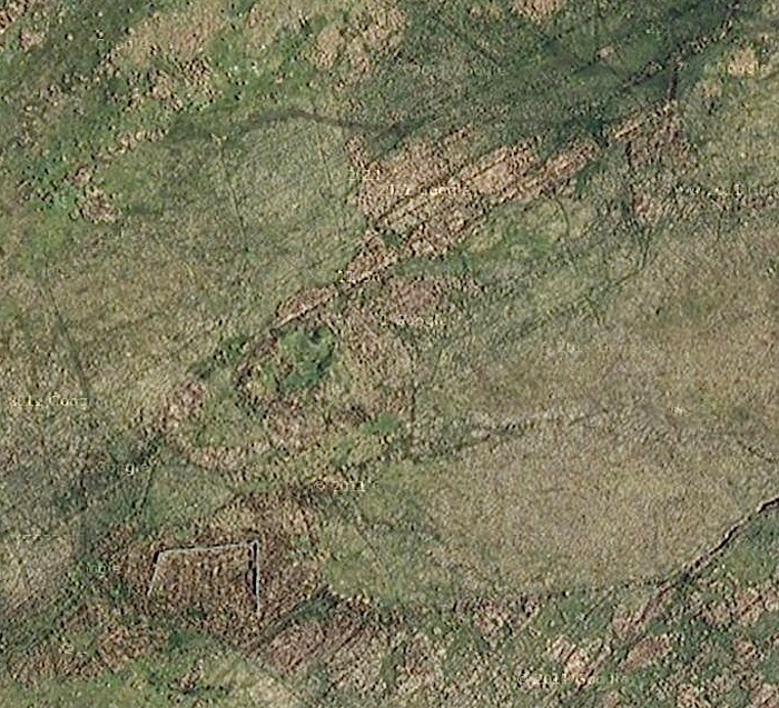
And this is a piece of hillside west of Toftholm Knowes.
I’m not sure what all of that is, but it deserves a better look.
“Stells” (the word comes from the Vikings) those stone enclosures, round and square, to herd sheep into are often built out of the remains of stone houses, since no-one liked to carry stone far. The light brown stuff is dried out bracken.
There could be “rig marks” i.e strip cultivation within that open sided rectangular enclosure?
(By now you will have realised that at least some of those old “reivers” were also growing a few “veggies?”)
And this sort of thing just goes on and on.
It’s tragic really, because given time and enthusiasm, it ought to be possible not just to locate all of those old towers and farmsteads, but also it ought to be possible to say just what families lived there. So…. If you are an Armstrong, Elliot, Nixon, Crozier etc., then you ought to be able to go and stand within the outline of the houses that your families once occupied.
But you can’t.
Yet all is not lost, because the Scottish Government, in a strange fit of generosity, has made all of the old maps available, “free gratis” via NLS MAPS! Now combine this with Google Maps, and without moving from your computer you can do your very own research!
Believe me, NLS Maps is one of the best resources ever. But if you want hard copy of the Pont Series on the Border…. Well, we actually do have copies for sale ourselves!
But scroll back to the map at the beginning of this post. See the two towers at the top of the frame? The ones marked “Goranberry.” Well, life is full of little surprises, because although the right hand one is gone without trace……. here are a couple of photo’s of what remains of the other one……..
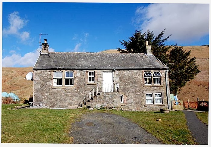

A much altered, and considerably modernised “Liddesdale Bastle House.” (Foundations and other “lower bits” probably dating back to the 16th century.
(The “Bastle house” is a sort of “economy version” of the better known and much larger “Pele or Peel Tower….. I’ll try and cover all of that in a later posting.)
Friends of mine used to live here, and farmed the land. You go up them stairs, and back down again into the lower storey.
It’s not recorded by the Historic people up in Edinburgh, but there is little doubt that this is the tower on Pont’s map.
There was a more original one at Toftholm, (on the bottom right of the Pont map.)
That wasn’t recorded either. It was used as a byre, and was demolished around 25 years ago!
Anywhere else in Britain, and it wouldn’t matter so much. But the people of Liddesdale are something of a “lost tribe” (like most of the Border Surnames), and we know almost nothing about them, or their culture. And that above is probably the only remaining inhabitable “bastle house” in the valley.
If you’ve read my earlier post “Hermitage Castle, in the footsteps of the Artists,” then you will also be aware of the “Gorrenberry Kelpie.”
I’ve had many a cup of coffee in that little “bastle” and if you have a feel for such things….. Well all I can say is that it has an “atmosphere”which is second to none. (And a pleasant one at that!)
And that’s a fine stone dwelling for 16th century Liddesdale, and proves that not everyone lived in relatively small turf houses.
That little building is precious, almost unique……..a gem well worth preserving.
11th February, 2014.
Just a small update.
 Speculation?
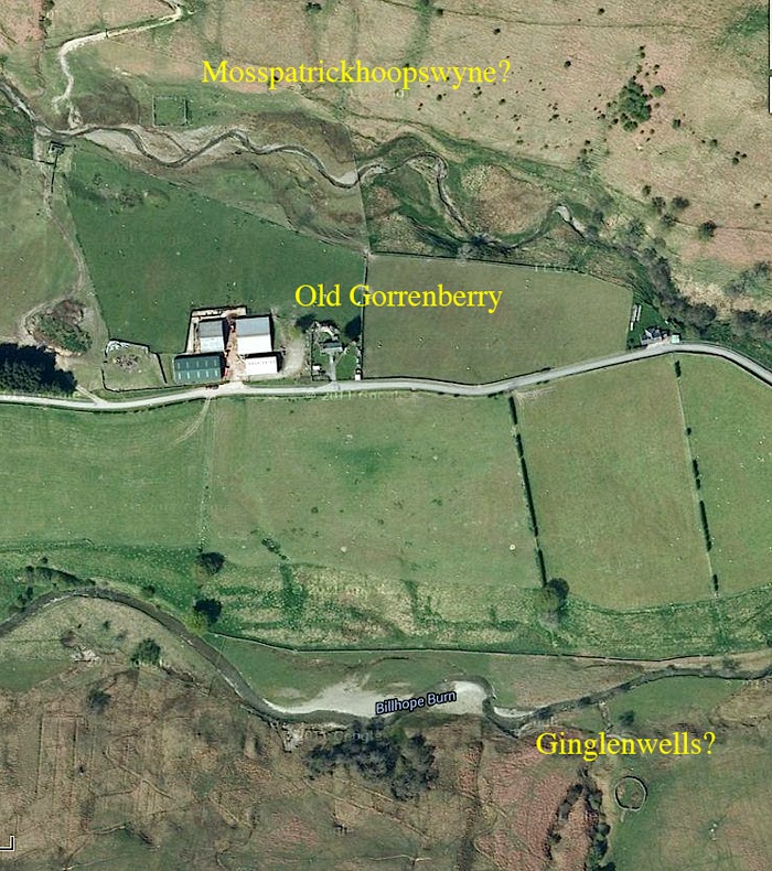
The “bastle” at Old Gorrenberry is just below the “d” in “Old.”
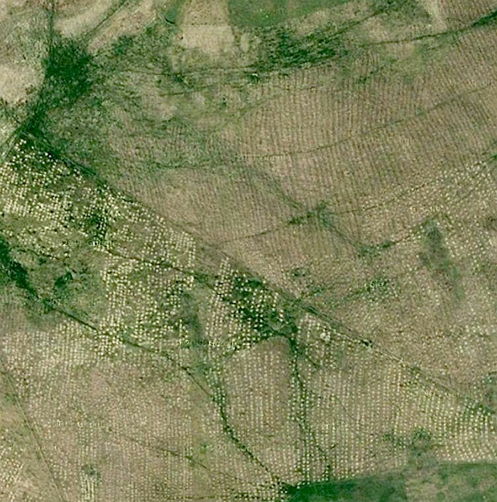
Sooo…… I pulled up the map again, and had a look for Mosspatrickhoopswyne, and Ginglenwells, because, due to the topography of the land, there are not many locations where they could be situated.
The land falls away from “Old Gorrenberry” both to the top and bottom of that frame. It falls to the two burns, and then rises sharply into quite considerable hills.
Remember that I said that they didn’t carry stone far to build those “stells,” and that they sometimes dismantled derelict houses to do so?
Well, pull that frame up on your computer, and have a good close look…..Mosspatrickhoopswyne…. (some mouthful that one is)…. probably lies below, and to the left of the capital “M” above.
And Ginglenwells, is probably below and to the right of the centre of the word itself. There could just be a rig cultivation system visible there, but on the other hand it may just be drainage.
But of course…. you must make your own minds up.
And I have no doubt at all that some archeologist will be spluttering in their coffee over all of this!
Whatever…. It looks like a good afternoon out when the weather gets fine, and I get rid of this flu!
14th of February 2104.
Still stricken down with “lurgi,” but we had to drive down to Newcastleton (Copshawholme to you initiates) yesterday to pick up some paperwork, so we decided to take the scenic route.
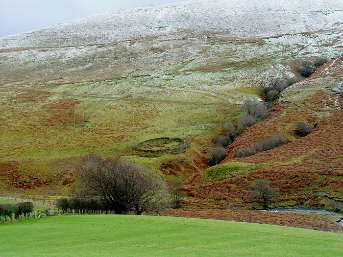
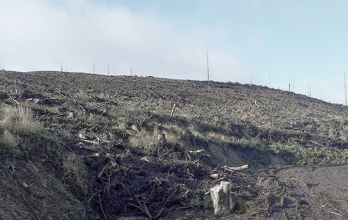
And this is an “on the ground” view of “Ginglenwells.”
It was a difficult drive, over higher ground than this, and we were up above the snow line for quite a way. The family played hell with me for even going out but as they saying goes… “you can’t keep a bad man down!”
Funny how those satellite shots flatten all of the landscape.
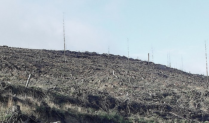
And I photographed this, around three hundred yards west……


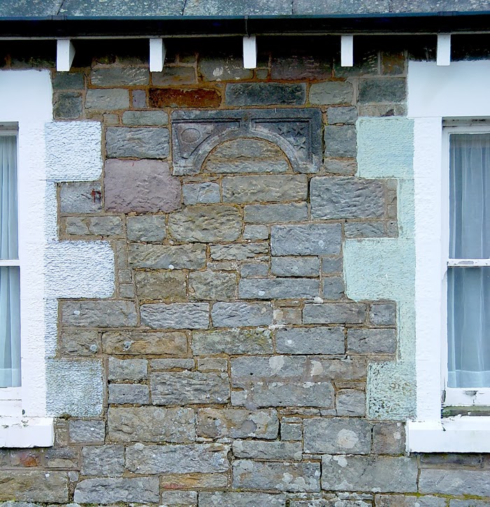
What’s this, built into the stonework between the windows…..?


In fact that statement is not exactly true, because the stone has been dated to the late 5th or early 6th centuries. And back then there really were no Scots…….. Which is probably why it is so little known.
Carantus, and his Dad, Cupitianus, were native Britons. What the Anglo-Saxons would refer to as the “Wealas.” Who are known today as “The Welsh.”
See my earlier posting, “Arthur in the Borders.”…… Because that is the thing….. here we have a memorial stone to two men, who are Native British Christians. Living within the “Arthurian Era.” Just ten miles from “Arthur’s Seat,” and around twenty two miles from Arthuret.
Conclusion….. If there ever was an “Arthur” on the Borders, then there is a good chance that he knew either Carantus, Cupitianus, or both of them.
So why is this not well known…… And once again I don’t know.
That stone above was an accidental find by a wee laddie….. Just what would turn up if there was ever an organised and systematic search?
Here is the best account I can find of the discovery……
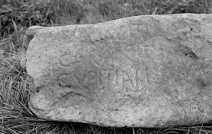
“In August 1933, a stone was found in the river bed of the Liddel, just below the inflow of Ralton Burn.
It was noticed by a small boy walking with his father, and described by the boy as having “printing on it.” It had evidently been incorporated in a dyke which had been washed away by recent flooding.
It was recovered form the river, and found to measure 5′ 8 inches. by 1′ 9 inches. by 11 inches., and to carry the inscription “Hic Iacet Caratini fili Capiteiani” (sic) which translates as “Here lies Carantus,
son of Capitanus (or Capitaneus)
The stone was dated at the time, or very shortly afterwards as late 5th or early 6th century, by Sir George MacDonald, K.C.B.
The Stone was presented to Buccleuch Estates, who in turn presented it to the National Museum.”
Who quite frankly have never made enough of it.
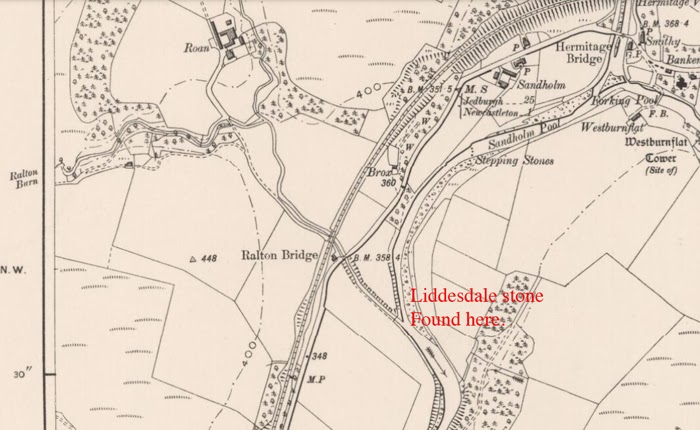
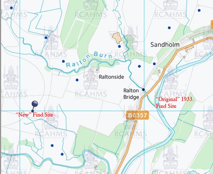
So…… There is no doubt at all where stone was found.
In the bed of the river Liddel, where the Ralton Burn runs in.
But where did it originally stand? In all probability not too far away. Possibly a little upstream?
Maybe….maybe not.
Unfortunately, a road alignment a few years back somewhat devastated the land just upstream, and as far as I know, no investigation of that land was made at that time. (I could of course be wrong).
But here are a couple of interesting photo’s.

Funny things these circular groves.
They are supposed to be incredibly old…. grow out over from the remains of one original tree, and the process just keeps on going.
But Alders are weird anyway. Scandinavian legend associates them with the Alder Maidens. Elf like creatures who dance at night, and lure young men away never to be seen again!
From the front they are beautiful, but their backs are hollow!
So beware!

These are they dancing!………. In a circle!
I think that with the Alder maidens we are touching on a very ancient tradition indeed. Remember Nimue imprisoned Merlin within a tree.
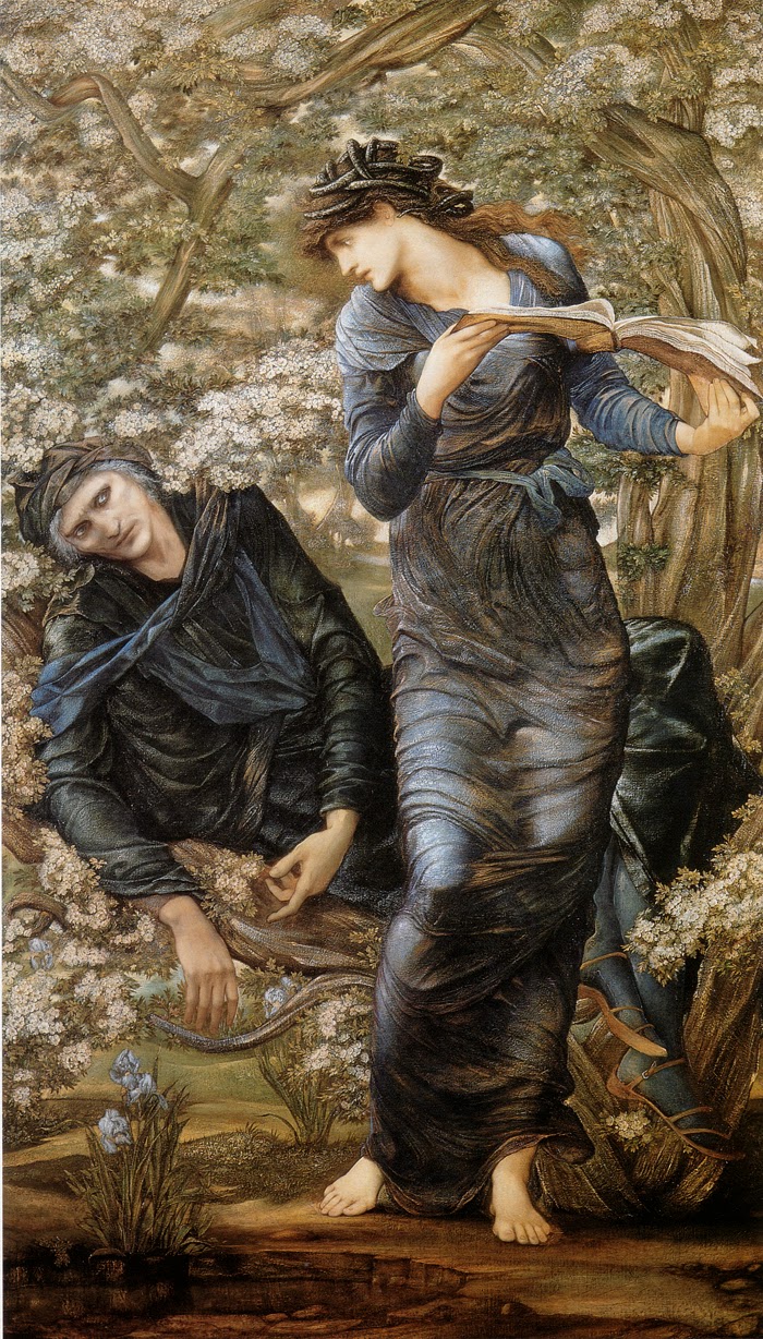
It illustrates Nimue reading from a book of spells, in order to lock poor old Merlin within, this time, a hawthorn tree.
In Shakespeare’s “The Tempest.” Ariel is imprisoned within a pine tree by the witch Sycorax.
Can’t find a decent illustration of that one. There are one or two about, but they’ve turned Ariel into one of those little “fairys” with butterfly wings!
However….. The subject of trees, sinister maidens, and the locking of persons within trees, is worth more research.
But look again at that photo of the Alder Grove. Because once again there are some interesting and unrecorded enclosures. And that photo was taken in May, you can tell by the hawthorn blossom, and in the morning. (angle of the shadows)
The time of year and light angle are important, because in differing light angles, different features of the landscape become visible. And Google maps get updated every few years. So if you see it today, you may well not be able to see it next year.
But give it a go….. because it is well worth it.
Oh, by the way…… You arms and armour enthusiasts may be interested to know that folklore and arms and armour do have a connection.

Much of what we know is due to good old Gustavus Adolphus of Sweden!
…… Who was more than just a soldier, he was also a folklorist, and instructed his priests to record all of the records of the old beliefs. Something which was certainly not done in Scotland!

